Fresh weather models are predicting a second cold snap late next week.
A cold northerly airflow has gripped the region over the past few days with temperatures struggling to reach 10 degrees Celsius.
A generally dry and sunny weekend will proceed a wet Friday night with comparatively mild highs of 12 degrees.
However, the weather is set to take a turn on Tuesday night.
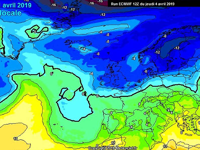
Carlow Weather's Alan O'Reilly took to Twitter yesterday, stating that the latest charts "do not make for warm reading".
The referenced models are predicting upper air temperatures of minus 8 degrees next Thursday, which will make for very cold conditions on the ground.
Latest GFS and ECM charts for this day next week do not make for warm reading! 🥶
Enjoy the weekend and check your heating oil🤬 pic.twitter.com/shpszIN2vb
— Carlow Weather (@CarlowWeather) April 4, 2019
