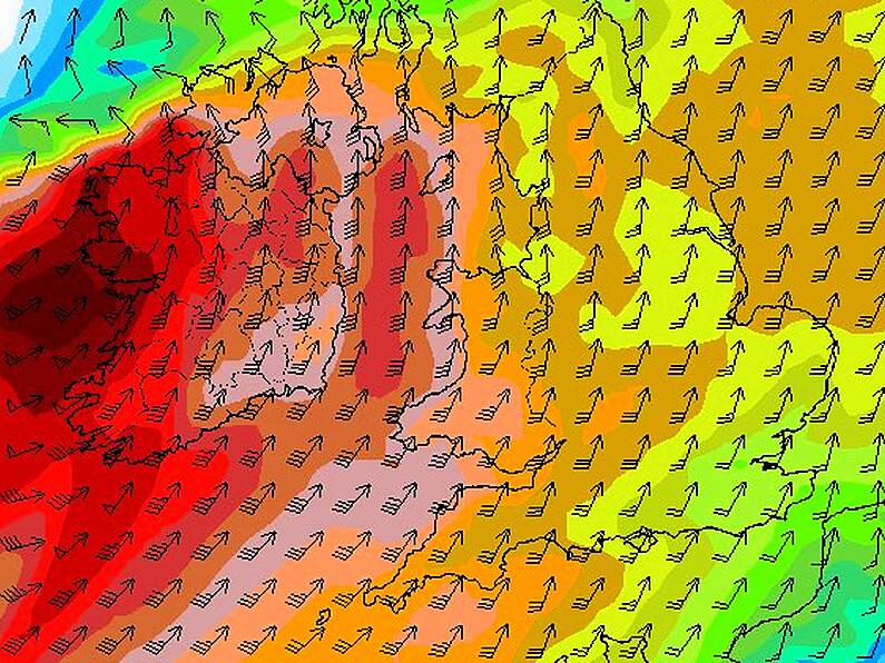
There are fears that two developing storm systems could pose a bigger threat than Storm Helene.
This evening from 8pm get set for #StormHelene in & out pretty fast but will pack a punch! Latest update @IrelandAMVMT
Style @NeonDublin @AranSweaterMkt pic.twitter.com/AUlOWt0KZV
— Deric Ó hArtagáinTV (@deric_tv) September 17, 2018
Ex-Tropical Storm Helene is due to track away from Irish shores tonight, but the South East may need to brace itself for stronger winds and heavier rainfall later this week.
Tentatively referred to as Storm Ali, the depression is expected to 'pack a punch' as it hits south-western shores on Wednesday.
Alan O'Reilly of Carlow Weather took to social media this morning, stating that the system's charts show potential for "damaging gusts".
GFS 06z charts still showing a stormy Wednesday and also wants to bring another system in again on Thursday but ECMWF doesn’t agree. pic.twitter.com/uIZErpm4QQ
— Carlow Weather (@CarlowWeather) September 17, 2018
Current projections suggest that another storm system, which could be called Storm Bronagh, may track towards Ireland in the late hours of Thursday night and early Friday morning.
However, that system's path is still unclear, meaning that there is a chance it could track towards the UK instead.
We'll keep you posted as the situation develops.
Image: European Centre for Medium-Range Weather Forecasts


