An ex-hurricane is expected to hit the south-east in the early hours of Tuesday morning.
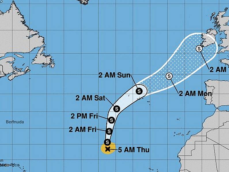
Early weather models show an extratropical cyclone, now known as Hurricane Helene, making landfall along the south-west coast of Ireland at 2am Tuesday, before tracking towards the south-east.
Met Eireann has warned that Ireland could experience "very disturbed weather", despite the cyclone weakening as it makes it way over colder north-Atlantic waters.
This far out it is difficult to forecast the final track, intensity and details but the latest guidance shows the center of the storm tracking very close to the south-west coast of Ireland and moving through Ireland with gusts of over 110kmh but most of the rain staying offshore. pic.twitter.com/Q67KCwXbWB
— Carlow Weather (@CarlowWeather) September 13, 2018
Irish weather expert Alan O'Reilly took to his Twitter page, Carlow Weather earlier today, stating: "latest guidance shows the centre of the storm tracking very close to the south-west coast of Ireland and moving through Ireland with gusts of over 110kmh, but most of the rain is staying offshore."
He also added: "It has to be stressed at this stage that the details will change over the coming days so keep up to date with the forecasts."
We'll keep you posted as the situation develops.
IMAGE: National Oceanic and Atmospheric Administration


