The traditional back-to-school heatwave could be about to make a comeback.
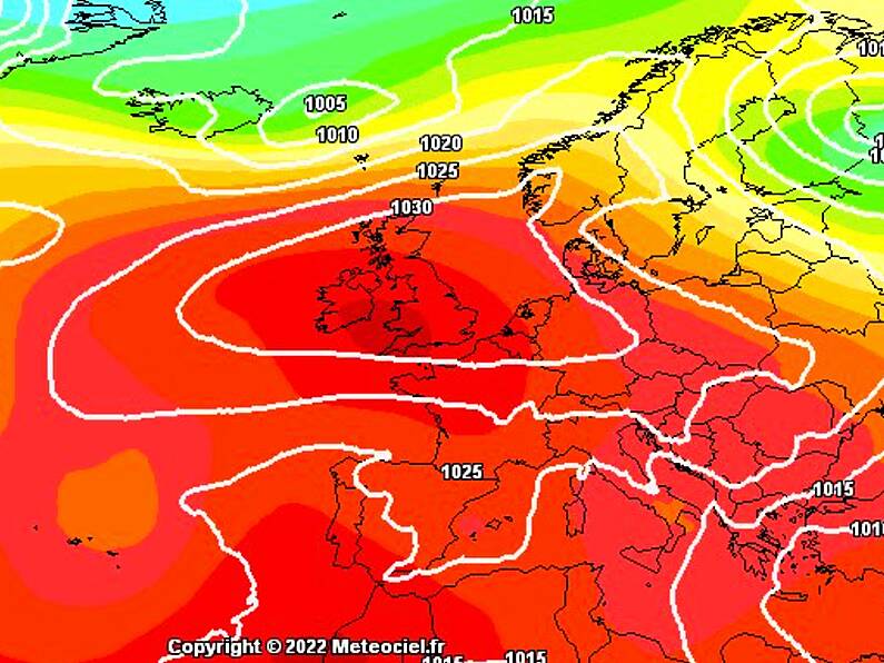
A long-range weather forecasting model has predicted that a plume of hot weather caused by a blocking high could make landfall by the end of August - just in time for the school return and Electric Picnic.
While Alan O'Reilly took to Twitter to state that these long-range weather charts are "only for fun" the "GFS model is trying its best to make it happen."
Back to school weather anyone? Well the GFS model is trying its best to make it happen ?
Please note these charts are only for fun, long long way off so very likely it could change but we can hope! pic.twitter.com/k2PNBVTCr0
— Carlow Weather (@CarlowWeather) August 16, 2022
The hopeful forecast means that we may not have seen the end of the summer just yet - a hope that's got many Twitter users excited:
"Jaysus Alan make it happen. We’re off on our holiers across the pond the 1st week of September", commented one follower.
While another said: "Last year was very warm when my little boy started school & they were allowed to wear shorts as it was too warm for the uniforms! Fingers crossed we have a bit more to look forward to!"
Coincidently, the forecast mirrors that of late August 2021 when highs of up 25 degrees were recorded in what was described as a "mini heatwave" by Met Éireann.
The settled, warm, dry spell lasted into the beginning of September.
Image: Meteociel.fr
